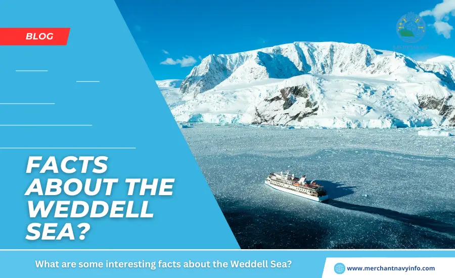
The Weddell Sea is considered the southern extension of the Atlantic Ocean and also marks the northernmost tip of mainland Antarctica. It is bounded to the west by the Antarctic Peninsula in West Antarctica. And also to the east by Coatsland in East Antarctica.
Its southern side is covered by a thick ice shelf. The eastern edge of the sea is defined by Cape Norvezia on the Princess Martha coast. Separating the Weddell Sea from the King Haakon VII Sea. The South Scots Ridge separates the area from the northern Scotia Sea, and also the Antarctic Peninsula from the Bellingshausen Sea.
The southern part of the Weddell Sea is covered with huge icebergs all year round. So shipping is dependent on weather and ice conditions. Therefore, cargo ships and barges are restricted to the northernmost part of the Weddell Sea.
The Weddell Sea is the Largest in the Southern Ocean
It is a vast ocean in the Antarctic Ocean, covering an area of about 2.8 million square kilometers. At its widest point, it is about 2000 km or 1200 miles wide. Located at the edge of a continent, the Weddell Sea is 1600 feet or 500 meters deep. Due to the break between the shelf and the continental slope. This is a large depth for the edge of a continent due to the large ice load. In Antarctica. The waters are claimed by the United Kingdom, Argentina, and the Antarctic Territories of Chile.
The Weddell Sea is said to be the cleanest ocean in the world in the 1980s. Scientists concluded that it had the clarity of distilled water. At 80 meters or 260 feet deep, the object is clearly visible from the surface. Making it one of the clearest bodies of water on Earth.
The Southern Ocean, also known as the Southern Ocean, is the southernmost area of the world’s oceans. Interestingly, the 2018-2019 Five Deeps Expedition was an expedition led by explorer. Former naval officer, and founder of Insight Equity Holdings. Victor Lance Vescovo, to find the deepest points in the world’s five oceans. His team used multibeam sonar to measure the deepest point in the Southern Ocean. They named Factorian Deep because it lies at a depth of 24,390 feet (7,434 meters).
It was Formed During the Jurassic Period About 145 Million Years Ago
The Weddell Sea shares a geological history with the rest of Antarctica and South America. It was formed by the collapse of Gondwana with massive volcanic eruptions under humid and warm conditions during the Jurassic period. The Weddell Sea formed as a southern extension of the Rocas Verdes Basin, which was seismically active at the time. In the Cretaceous period, this basin was transformed into a foreland basin called Magallanes. Although these geological processes occurred in South America, the Weddell Sea was spared these changes and retained its ocean basin characteristics.
It was Discovered in 1823 by Scottish Explorer James Weddell
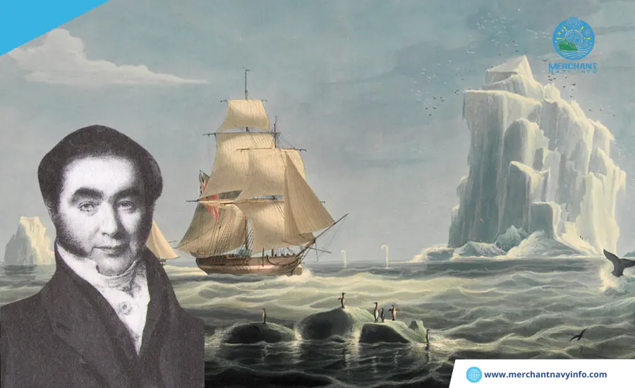
The Weddell Sea was discovered by British explorer James Weddell, a famous seal fisherman who first navigated the waters in 1823.
He called it “King George IV’s Sea,” but it was later renamed in 1900 after James Weddell.
The Weddell Sea was not navigable in the 19th century. Otto Nordenskjöld, a Finnish geologist and leader of the Swedish Antarctic expedition, had been living on Snowhill Island for almost a year when his ship was crushed by an iceberg floating in the Weddell Sea. The expedition, which began in 1901, was a failure, and the entire crew stranded on Paulet Island was rescued from Hope Bay. However, only one member survived.
The Ronne-Filchner Ice Shelf, the Second-Largest Antarctic Ice Shelf in the World, Borders the Weddell Sea
The Ronne-Filchner Ice Shelf is divided by Bergner Island into the Eastern Ice Shelf (Filchner Ice Shelf) and the Western Ice Shelf (Ronne Ice Shelf). With a total area of approximately 430,000 square kilometers, it is the second-largest ice shelf in the world. They grow huge due to the influx of large amounts of ice sheets, but periodic calving can also cause ice sheets to peel off and form gigantic floating icebergs.
The Ronne Ice Shelf is the largest of the two ice shelves and is bounded to the west by the Antarctic Peninsula. It was first discovered in 1957 by Finn Ronne, leader of the Ronne Antarctic Expedition. The Filchner Ice Shelf bordered Coatsland to the east and was discovered in 1912 by a German Antarctic expedition led by explorer Wilhelm Filchner. This glacier is fed by Slessor Glacier, a restorative and supporting glacier near Berkner Island.
The Ronne-Filcher Ice Shelf, 600 m thick and 1400 m deep at its deepest point is of great interest to biologists and scientists who believe it holds the secrets of the paleo-marine environment. I am. Extinct plants and animals may be discovered. Additionally, an international program to study ice shelves was launched in 1973 year.
The Weddell Sea is Part of Many Ancient Myths and Legends
The Weddell Sea region was described by historian and explorer Thomas as one of the harshest, most desolate, yet most breathtaking places on Earth. R. Henry was the first to write about the Weddell Sea and also Antarctica.
His book The White Continent was published in 1950 and was the first work to describe in detail at the climate, weather, flora, and fauna of Antarctica, which was largely unexplored at the time. He accompanied Admiral Byrd on his Antarctic expedition in 1946 and 1947, which led him to write about his extraordinary experience.
The Weddell Sea is One of the Few Places Where Deep Water Masses form and Contribute to Global Thermohaline Circulation
The Weddell Sea has an extremely cold climate with strong winds and icy seas. However, the ocean is most important because it regulates global climate and global ocean current circulation through the process of thermohaline circulation. Thermo means heat and halain means salt.
One of the Two Eddies in the Southern Ocean is Located in the Weddell Sea
The western Weddell Sea has a northward current that is part of a wind-driven low-pressure system known as the Weddell vortex. This northerly flow is the main source of water outflow from the Weddell Sea, which is a deep-sea water change site. It consists of cold, slightly salty surface water, separated by a narrow pycnocline from a thicker layer of relatively warmer, more saline water, the so-called Wendell Deep Water.
The Weddell Sea is Home to Many Seals, Penguins, and Whales
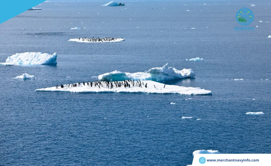
The icy waters of the Weddell Sea are home to a wealth of marine life, including seals, penguins, and various species of whales. Weddell seals are a common species found primarily in coastal areas. Although named after the ocean, they are found throughout Antarctica. Crabeater seals are smaller than Weddell seals, up to 2 meters long. This is also a species that can be observed on icebergs. They are being targeted by leopard seals, one of Antarctica’s biggest predators. Not only do they kill other seals, but they are also known to be aggressive and have even attacked humans.
Adelie penguins are easy to spot in the thick ice of Antarctica. Although they are small, they are easily identifiable by the white circular markings around their eyes. A few years ago, scientists discovered a colony of emperor penguins, the largest penguin species, on Snow Hill Island.
It Offers Many Exciting Adventures for Intrepid Explorers.
Thanks to advances in shipping technology and the invention of icebreakers, much of the Antarctic region can now be explored. If you are an avid adventurer, you can reach the northwest part of the ocean. The rest is covered with a thick and impenetrable layer of ice. Many routes are available to Antarctica, but the Weddell Sea is close to Argentina. And sea cruises depart from the resort of Ushuaia, Argentina’s southernmost city. It is a famous tourist destination offering skiing, tours to the Tierra del Fuego National Park, and visits to the Marcial Glacier.


