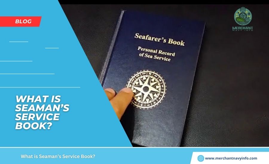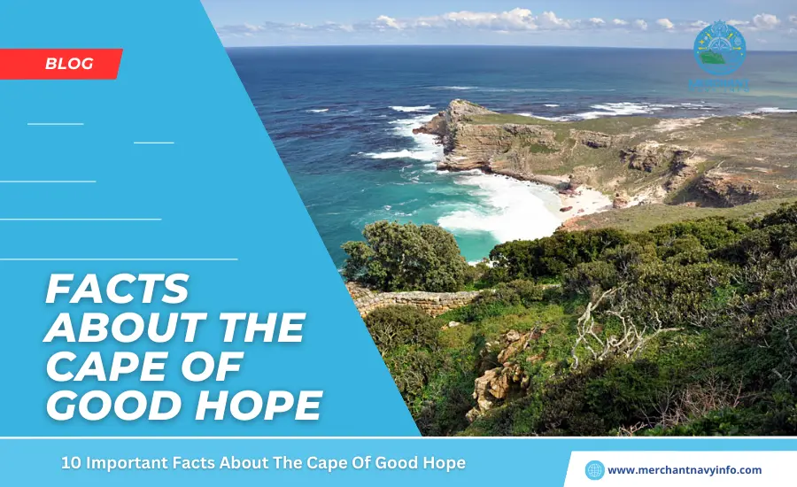
A cape is a headland that extends into a large body of water, such as an ocean, sea, or river. They represent topographical changes in the coastline and are susceptible to tidal influences, especially erosion. They have a short geological lifespan and also are formed through a variety of processes. Moreover, some parts are islands, while others are part of a land mass, such as the Cape of Good Hope in South Africa. Geographers point out similarities between peninsulas and also capes. However, the latter are smaller and usually narrower. The peninsula is huge and also not necessarily connected to the mainland.
Let’s Explore Some of the Amazing Features of the Cape of Good Hope
1. Formed During the Last Ice Age
Between 115,000 and 11,000 years ago. The Cape of Good Hope was formed during the Ice Age, which began at 2.6 million years ago. Glaciers covered much of the Earth’s surface and began to melt during interglacial periods. Rising water levels and sediment from former ice sheets deposited on the coast, forming rocky headlands.
Similarly, strong waves carrying sand and silt were deposited and, at the same time, eroded the coastal rocks, forming a promontory on the Atlantic coast of Africa as a part of the Table Mountain range. Its edges were made of sandstone and were easily eroded by the forces of wind and water, leaving behind a hard, jagged promontory.
2. It was Discovered in 1488 by Portuguese Explorer Bartolomeu Díaz
The discovery of the Cape dates back to the Age of Discovery. From the 15th century to the 16th century, European powers such as Spain, Portugal, and the Netherlands sent royal missions to uncharted lands to discover wealth, expand their empires, and spread Christianity to new subjects. This was a great opportunity for independent sailors and explorers to gain favor with the king. One of these explorers was Bartolomeu Díaz, the first European to discover the Cape of Good Hope in an attempt to find the southernmost tip of Africa. He then discovered trade routes from Europe through the Atlantic and Indian Oceans to Asia.
3. Originally Known as Cape of Storms
Rocky Cape was originally called Cape of Storms by Diaz. Diaz’s crew feared harsh weather and tidal conditions. Navigation was dangerous due to frequent storms in the area. King John II of Portugal then renamed it the Cape of Good Hope, saying it would allow his empire to trade with Asia.
4. The Cape of Good Hope Served as a Trading Post
For Europeans, it has an important place in South Africa’s trading history. It served as a staging area for ships heading from Europe to the colonies in the Far East. However, in order to gain control of the Cape, Europeans brutally drove the indigenous Khoikhoi from their land. A supply camp is established on the Cape Peninsula near the bay by the Dutch East Company. It provided food, water, and shelter for arriving sailors and later took the form of a full-fledged settlement called Cape Town. It was founded in 1652 by Dutch merchant Jan van Riebeeck near Table Bay. The Cape was under Dutch administration from 1652 until 1795.
5. Experience a Pleasant Mediterranean
Climate Coastal areas along the Cape enjoy a mild Mediterranean climate, as do south-central California, parts of Chile, Australia, and coastal areas of the Mediterranean. Winters are mild, and summers are warm and dry. Summer Winds is nicknamed “Cape Doctor” by locals. These winds blow pollutants out of the area, purifying the air and dissolving oxygen in the shallow waters of the bay, which provide habitat for marine life, especially crabs, lobsters, and small fish.
6. Also known as the Ship Graveyard
At Cape, he has over 1000 shipwrecks. For this reason, it is widely known as a ship graveyard. Sailors are advised to use caution underwater while maintaining average sailing speed. Swallows the British cargo ship Arniston, which was transporting wounded soldiers from Sri Lanka. On May 30, 1815, the ship encountered a storm and mistook Cape Agulhas for Cape Point. Captain George Simpson steered west and reached the steep reef without an anchor.
He tried to turn the ship around but to no avail. Only 6 out of 378 survived. In memory of the deceased, a nearby town was named Arniston, and a museum was built to tell the sad story of the British soldiers who went home. Lighthouses were also built on the reefs to prevent ships from following the unfortunate path. Today, the Arniston shipwreck is a diving spot explored by many tourists visiting Cape Town.
7. The Subject of Numerous Myths, Legends and Poems
The Cape of Good Hope is beautiful but also dangerous. Many legends are told by local fishermen and residents, including sightings of mermaids, sea monsters, and paranormal phenomena. One of the most popular is the haunting pirate legend or myth of the Flying Dutchman. The story is depicted in movies, books, and TV shows and is well-known to many. Many believe that the ship was cursed to sail the Cape’s waters forever. Although this is a legend, people claim to have seen the ghost ship on stormy nights and foggy days. Sailors named the ship “Flying Dutchman” because it seemed to never touch the water. Interestingly, Cape Point has a train named after a ship.
8. The Cape of Good Hope is a Popular Tourist Destination
The main attractions near the Cape of Good Hope are sandy beaches and seaside resorts. Travelers can contact local tour operators or explore the area on their own. It’s the perfect place for nature lovers and adventure sports enthusiasts. The rugged mountains are perfect for hiking and camping. The authorities often organize bicycle competitions and yacht races.
You can also enjoy fishing, diving, surfing, angling, and bird watching. The Cape is located within Table Mountain National Park and is a beautiful location. From Cape Point, winding roads lead to Smitswinkel Bay and Miller’s Point. The former is a famous diving spot, and the latter is home to a diverse population of baboons.
9. South Africa’s Important Maritime Gateway
The Cape of Good Hope is a landmark for ships bound for East Asia and Australia. There are several South African ports near the Cape, the largest being the port of Cape Town. Cape Town Harbor is located in Table Bay, just a few miles from the Cape of Good Hope, and features four basins and 34 berths. Commercial cargo vessels are handled at Duncan Pier and Schoeman Pier. Private mooring facilities are available in Victoria.
Basin and the Alfred Basin are protected by two major breakwaters. The region is an important agricultural region, with citrus fruits, juices, canned and fresh seafood, vegetables, polymers, rice, metals, meat, cement, and copper making up the majority of exports. Imported goods include heavy machinery, steel products, lumber, sporting goods, clothing, and chemicals. Approximately 3,000 ships with more than 8 million tons of cargo and 300,000 TEU call at the port each year.
10. Africa’s Major Biodiversity Hotspot
The Cape Peninsula is a protected area and UNESCO World Heritage Site, covering an area of over 480 square kilometres. It is home to over 2,500 species of plants and animals. At its southern tip is the Cape Botanic Gardens, which covers 0.5 percent of the African continent but is home to more than 20 percent of Africa’s endemic flowering plants. The most common are shrubs or shrubs called fynbos.