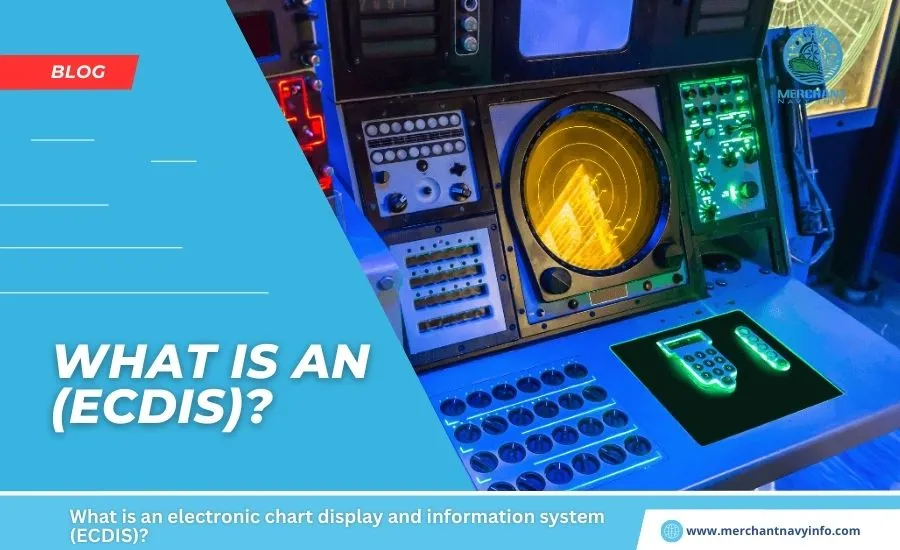
Electronic Chart Display and Information System (ECDIS) is an evolution of the chart systems used on warships and ships. The use of electronic chart systems has made it easier for ship crews to identify their location and get their bearings. ECDIS complies with IMO Regulations V/19 and V/27 (as amended) of the SOLAS Convention by displaying selected information from System Electronic Navigation Charts (SENCs). Devices that comply with SOLAS requirements can be used as an alternative to paper charts.
ECDIS uses the functionality of the Global Positioning System (GPS). I can successfully find navigation points. It should also be noted that ECDIS complies with the requirements of the International Maritime Organization, thus contributing to the reliability of electronic chart systems.
ECDIS is basically a navigation information system that is connected to other navigation devices such as GPS, gyro, radar, ARPA, and depth sounders. ECDIS also integrates and displays information contained in other maritime publications such as tide tables and navigation instructions, and also integrates additional maritime information such as radar information, weather, ice conditions, and automatic vessel identification .
Advantages of ECDIS over Paper Charts
- All information is processed and displayed in real-time
- Eases the navigation planning process
- All necessary navigation information is available at a glance
- Alarms and Location and highlighting of hazards where indicators are provided
- Chart correction is easier with ECDIS than with paper charts.
- cards can be customized to suit your travel needs.
- You can overlay and integrate other navigation devices such as AIS, ARPA, etc.
- You can arrange the charts as needed.
- The ability to zoom in and out allows you to inspect features as needed.
- You can get more accurate information. You can query detailed information on the ETA
- Overall navigation safety is improved.
ECDIS Card Types
Raster Chart (RNC)
RNC is a direct copy or scan of a paper chart. All the information displayed is printed directly, so it looks exactly like a paper map. When you zoom, the graph just gets bigger or smaller; when you rotate it, everything rotates.
Vector Map (ENC)
ENC is a computer-generated map. ENC details can be turned on or off according to user requirements. Click on any object on the ENC for more information. It can also monitor depth and issue stranding warnings. Zooming makes the element larger or smaller, but the text remains the same.
ECDIS is:
- SOLAS Chapter 5
- Port State Control Requirements
- IMO Performance Standards for ECDIS
- S52 Standard (Display Standard)
- S57 Standard (Compilation Standard)
- S63 Standard (IHO Data Protection/Encryption Standard)
ENC Level (Electronic Navigation Charts)
- Basic Display (information cannot be deleted)
- Standard Display
- Full Display
- Custom Display
Minimum Interface Requirements
- Position Sensor
- Orientation Sensor
- Speed Sensor
ECDIS Compliance
- Approved ECDIS with Approved Backup
- Type Approved Hardware
- Type Approved Software
- Approved Installation
- Official Chart Service
- Officer Training
Chart Update
ECDIS chart updates can reach the vessel in a variety of ways, depending on the service provider and the capabilities of the onboard communications equipment.
- Data carrier (DVD)
- As email attachment (SATCOM)
- As a broadcast message via SATCOM and additional communication hardware
- As Internet download
Travel log
- Last 12 minutes Recorded Mileage
- Six months of mileage recorded every 4 hours
Dual Fuel
Dual Fuel is the use of RNC when ENC is not available on an approved paper chart backup.
Alarms and/or indications in the ECDIS
Alarm:
- Exceeding the track crossing limit
- Traversing the selected safety contour
- Deviation from the route
- Approaching a danger point
- Difference in date with the positioning system
Alarm or Display:
- For maximum scale alarm (current map scale too small)
- Areas with special circumstances
- ECDIS malfunction
Display:
- Map scale exceeded (zoomed in too close)
- Larger ENC scales available
- Different reference units
- Route crossing safety contours
- Specific areas where route crossing alarms are active
- System test errors
For better understanding, indicators can be either visual or audible. The alarm must be audible and can also be visual.
Power Supply:
- It must be possible to operate the ECDIS and all equipment required for normal operation when powered by the emergency power supply.
- There is no need to manually reinitialize the equipment when switching from one power source to another or when power is interrupted for up to 45 seconds.
Transport Requirements:
- Passenger ships > 500 GT New construction – until July 2012 Existing construction – until 2014 (built before July 1, 2012)
- Tankers > 3000 GT New construction – until July 2012 Existing construction – Until 2015
- Cargo ships > 10000 GT New construction – Until July 2013 Existing construction – Until 2018 (built before July 1, 2013)
- Cargo ships > 3000 GT New construction – July 2014 Up to
- Cargo ships > 50,000 GT Existing construction – Until 2016
- Cargo ships > 20,000 GT Existing construction – Up to 2017
Limitations
The accuracy of the information received via the AIS is dependent on the AIS transmitted. The accuracy of the information is about the same. The same applies to all other devices connected to ECDIS. The vessel position received on the ECDIS display may not be referenced to the WGS 84 datum.Undue reliance on her ECDIS for navigational safety should be avoided until all data transmitted, received, and displayed is confirmed to be accurate.
Users must be aware that incorrect information may affect the safety of their vessel and other vessels.Some sensors may not be accurate enough or may not have been tested.Not all ships are equipped with her ECDIS, so we cannot be sure of her technical capabilities regarding positioning and navigation.It is never recommended that an ECDIS-provided type OOW rely solely on information within her ECDIS. It is just a navigational aid, not a substitute for the human commodity, a combination of skills, expertise, and experience that ECDIS can never provide.
IMO Performance Standard for ECDIS
The main function of ECDIS is to contribute to safe navigation. With appropriate backup arrangements may be recognized as compliant with the current chart according to regulation V/20 of the SOLAS Convention of 1974. In addition to the general requirements for marine radio equipment and electronic navigational aids contained in IMO resolution A.694 (17), which are part of the GMDSS, ECDIS must meet the requirements of this performance standard.
ECDIS must be capable of displaying all nautical chart information necessary for safe and efficient navigation, produced and distributed by a nationally licensed hydrographic office. Should enable easy and reliable updating of electronic charts. ECDIS reduces navigation workload compared to using paper charts. This should allow mariners to conveniently and quickly perform all the route planning, monitoring, and positioning that is currently done on paper charts. It must be possible to continuously record the ship’s position. ECDIS must have at least the same reliability and availability of representation as paper charts issued by nationally authorized hydrographic offices. The ECDIS must provide appropriate alarms or indications related to displayed information or equipment failure.
ECDIS Training
There are many institutions that conduct ECDIS courses. This is typically a five-day in-depth course and requires the candidate to have completed her one year at sea as a deck cadet. Each institution has a different price range for their courses, so you should check on the institution’s website itself. laboratories must also check approvals by the respective governing bodies of the country (such as his DG Shipping in India).
ECDIS knowledge, skills and understanding must be emphasized as more ships incorporate ECDIS into their systems. The same will be achieved through a simulator during the study period. Almost all educational institutions also require possession of an ROC ARPA competency certificate as a prerequisite for taking an ECDIS course.