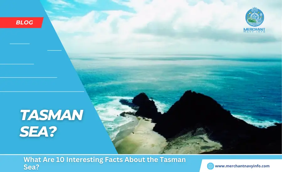
The Tasman Sea, located between the land masses of Australia and New Zealand. Is the marginal sea of the South Pacific Ocean in the Eastern Hemisphere. It is an important trade route between regions of Oceania, between Australia and also New Zealand. And the Tasman Sea carries a significant amount of trade between the two countries.
Similarly, ships bound for other parts of the world pass through the Tasman Sea to countries in Southeast Asia. Or across the Pacific Ocean to reach America. The Tasman Sea was a first explored by European sailors and cartographers. In the mid-17th century as part of the British and Dutch Empire’s plans for world conquest. This article explores ten interesting facts about the Tasman Sea. Filled with interesting historical and geographical facts, it is sure to be an interesting read.
The Tasman Sea Is Named After Dutch Explorer Abel Tasman
This unique name comes from Abel Janszoon, a 17th-century Dutch explorer whose Tasman. (1603 – 1659) Travelled extensively as a member of the Dutch East India Company (VOC). He is considered the first European explorer to visit New Zealand and also Tasmania. A keen sailor and explorer, Abel Tasman was also a merchant interested in the Council of the East Indies. Council bosses regularly sent explorers to far-flung lands, and Tasman was one of the explorers travelling throughout the Eastern Hemisphere.
His first major voyage in 1642 was to explore the so-called ‘Beach States,’ now known as Australia and Zealandia. Many of the landmarks around Oceania are named after Tasman,Tasman, who served as governors and naval commanders. His first voyage was to Australia and New Zealand. And his expedition team was the first group of Europeans to land in the region. On his next voyage in 1643-1644, he explored further into northern Australia, naming the country “New Holland”.
The Ocean Stretches for Almost 3,000 Kilometer’s from North to South
The Tasman Sea is no small body of water, covering an area of over 2.3 million square kilometres. Its length is about 3,000 kilometres, and from east to west, it is another 2,200 kilometres. The ocean’s maximum depth is 5,500 meters, and also it is located near a series of ridges. And peaks in the Mid-Ocean Ridge of Zealandia. The ocean, which lies between the landmasses of Australia and New Zealand. Is a vast body of water that can be dangerous to cross at certain times of the year. This is mainly due to poor wave conditions over thousands of kilometres at a time.
The Geological Base of the Ocean is Composed of Unique Siliceous Biogenic Muds
Most oceans and large bodies of water on Earth have rocky bottoms. This occurs through a cycle of subsurface melt eruption. Cooling to the rock surface, and erosion into the final sedimentary or powdered soil. The flora and fauna found at the base are generally limited to a few plant. Species adapted to the reduced of sunlight and presence of an dissolved oxygen. Corals are usually found near the ocean floor. And also are often covered in small plant species that cover sparse areas of the ocean floor. In some regions of the world’s oceans, underwater currents prevent small organisms and plankton from establishing near their bases.
The Tasman Sea is Close to Other Major Bodies of Water
The importance of the Tasman Sea in the global supply chain and a logistics sector. Is primarily due to its proximity to an other major water bodies. To the east lies to Pacific Ocean, the largest body of water on Earth. And is an important shipping route connecting the Americas and East Asia. There are large canals and straits between the Pacific and Atlantic oceans. So there is a lot of transportation from Europe and Africa.
Cape Horn is the southernmost point of mainland South America. Meanwhile, the Strait of Magellan is a natural transition between her two oceans. And is located slightly north of the cape. Further north, the Panama Canal connects the east coast. Of the United States with ports in Asia and the Tasman Sea. To the west of the ocean is the Indian Ocean, one of the wildest bodies of water on Earth, with extreme wind and wave conditions almost all year round.
There are Several Large Cities Along the Tasman Sea Coast
The Tasman Sea is an important trade route between New Zealand and also Australia. Despite the harsh weather and surf conditions, there are several ports on both coasts that provide shipping services. New Zealand has a small commodity market and is dependent on a trade with Australia to meet the needs of its growing population. These ports transport a variety of products, from chemicals and metal ores to agricultural products and livestock.
Australian and New Zealand ports are famous for exporting livestock around the world, from the Americas to the Middle East. Major ports in the Tasman Sea include South West Locks, Darling Harbour, Kaipara Harbour, Newcastle Harbour, Batemans Bay Marine, Mallacoota Harbour, Hythe Southport, Auckland Harbour, Port Nelson, Sydney Harbour, Greenwell Point and Flinders Island Harbour.
The Tasman Sea is One of the Roughest Bodies of Water on Earth
Wind and wave conditions in the Tasman Sea are rough for most of the year. Below 40 degrees north latitude, low-pressure systems regularly move over the ocean from west to east. The importance of this latitudinal restriction is that these headwind conditions have been named “Roaring Forties.” However, between April and October, the wind direction reverses from east to west, resulting in extreme wind activity.
Crossing the Tasman Sea by boat or kayak is difficult because, for most of the year, headwinds blow out to sea and counteract the trade winds (easterly winds). Wind causes surface currents that further increase wave activity. Many travelers crossing the Tasman Sea have fallen prey to the deceptive nature of wind and wave activity in the region.
Captain James Cook Was One of the First Explorers of the Tasman Sea During His Voyages
Captain James Cook (1728 – 1779) was a famous British sailor and cartographer who made three extensive voyages across the Pacific Ocean between 1768 and 1779. His main research focused on Oceania, and he is credited with being the first to record circumnavigating the New Zealand mainland. During his first voyage with the Royal Navy in 1768, Cook sailed to New Zealand, where he accurately charted much of the coast.
This trip brought him into contact with the Maori people, earning him the distinction of being the first recorded European to meet the indigenous people. After his first expedition to New Zealand, Cook returned to England via Jakarta through the Indian Ocean.
The Tasman Sea is Locally Known as the ‘Ditch’
A commonly used phrase is “cross the pond,” referring to the North Atlantic Ocean. Back when steamships and luxury liners sailed between Europe and North America, the Atlantic Ocean was jokingly called “The Pond” because of its size. Early explorers misjudged the size of the body of water and thought it would be easy to cross. The discovery of the Americas by Columbus and Amerigo Vespucci ensured that the actual size of the ocean was much larger than a “pond.”
An Ancient Megalodon Tooth was Found in the Ocean
Megalodon made famous in the 2018 film The Meg, is an extinct shark that lived 3.6 million years ago. Meg is related to the mackerel shark and is known as Otodus megalodon. A complete skeleton of Megalodon does not exist, and its size has been estimated from partial and fragmentary fossils. Meg’s teeth are the most important skeletal remains found at prehistoric sites, and these are used to estimate the size of creatures. Estimates suggest that the shark is between 10 and 20 meters long, making it one of the largest known predators on Earth.
Crossing The Tasman Sea is an Adventure Sport and Competitive Event
The Tasman Sea is one of the wildest bodies of water on Earth, which is why several competitions and annual events are held aimed at attempting ocean crossings.
Most of the challenges are run from the Australian side towards New Zealand in hopes of catching a tailwind and going faster. Competitive events typically do not involve crossing entire oceans but instead, focus on participants covering hundreds of kilometres in kayaks or yachts before returning to shore. These events are held locally and are often held in the middle of the calendar month when surf and wind conditions are somewhat calm.