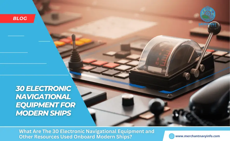
Gone are the days when a ship navigation officer had to take the help of unconventional ways to design and navigate a voyage at sea. Today, a ship officer has myriads of marine navigational equipment. This makes his life a lot simpler, thanks to the advancement in technology. This is what has made the journey at sea smoother and safer.
1)Gyro Compass
It is used for finding the correct direction. Its repeater system has to be present in the steering platform in case of emergency steering.
2)Radar
The seagoing vessels rely on S-band and X-band frequency radar system for navigation. The reason is as it is able to detect targets also display the information on the screen. This includes the distance of the ship from land, any floating objects, other vessels, and obstacles to avoid a collision. It is a rotating antenna which discovers the near by area of the ship.
3)Magnetic Compass
The magnetic compass works in unison with the magnetic field of the earth and is the main means of the direction indicating device. This ship’s navigation machinery, typically located on the centerline of the vessel’s “monkey island,” utilizes a transmitting magnetic compass to obtain a planned course for the journey. This compass transmits data that’s displayed on the bridge equipment and panel.
4)Auto Pilot
The ship bridge equipment with its layout is filled with equipment and tools used for navigation. The reason is it assists the human operator in controlling the ship. This done by keeping the steering in autopilot, which allows them to concentrate on main aspects of the operation.
The ship’s steering mechanism is controlled remotely (from the Navigation bridge) using a combination of three different systems
5)ARPA
Automatic Radar Plotting Aid displays the position of a ship and other vessels nearby. The radar shows the position of the boats in the vicinity and picks the course for the ship by avoiding any kind of collision.
6)Automatic Tracking Aid
Just like ARPA, automatic tracking aid displays the information on tracked targets in graphic and numeric to generate a planned layout for a safer and collision-free course.
7)Speed & Distance Log Device
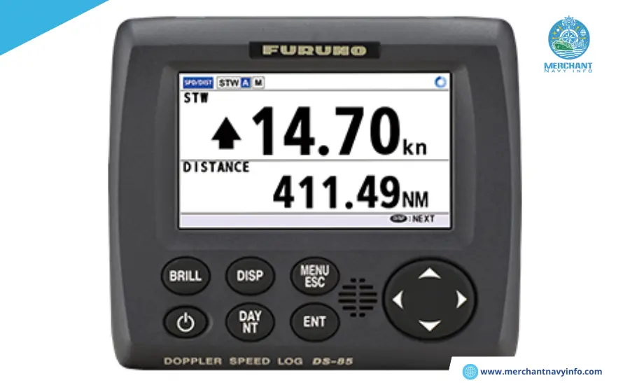
This bridge equipment on a vessel actively monitors a ship’s speed and distance travelled from a set point. Using these calculations, the equipment adjusts or provides the ship’s Estimated Time of Arrival (ETA) to both port authorities and agents.
8)Echo Sounder
There are many modern ship navigation tools present on the ships, and an echo sounder is one of the instruments which have been in the play for almost 100 years now. Sound waves are used to check the depth of the water under the ship’s bottom. They work on the principle of transmitting sound waves and an audio pulse that bounces off a reflecting layer, returning as an echo to the source.
9)Electronic Chart Display Information System
ECDIS is a development in the navigational chart mechanism used in naval vessels and boats. With the use of the electronic navigation technology, it has become easier for a boat’s navigating crew to pinpoint locations, and finding directions are easier than before.
10)Automatic Identification system
AIS is also among the types of navigation systems that help to pinpoint the location and other navigational aspects of ships. AIS uses VHF radio systems as transmitters and receivers to send and receive communication between ships, which endeavours to fulfil many responsibilities.
As per the regulation ordered by The International Maritime Organisation (IMO), all vessels and commercial ships which carry people are over 299 Gross Tonnage (GT). These are in the international to carry a Class A AIS transponder.
11)Long Range Tracking and Identification (LRIT) System
The International Maritime Organization (IMO) implements this system under its SOLAS rules to ensure a comprehensive tracking technology for ships of 300 gross tons and above that undertake international voyages across the world. This maritime machinery aims to improve maritime domain awareness.
12)Rudder Angle Indicator
Rudder angle indicator, as the name indicates, provides the angle of the rudder. The display is provided on the navigation bridge equipment console so that the ship navigation officer can control the rate of turn and rudder angle of the ship.
13)Voyage Data Recorder
This recorder records the whole journey. It contains a voice recording system for a duration of at least the last 12 hours. This recording is recovered and used for investigation in events of accidents. The worth of VDR is similar to a “black box” fitted on an airplane.
14)Rate of Turn Indicator
This navigational tool indicates how fast the ship is turning at a steady rate (useful during pilotage and manoeuvring), normally shown as a number of degrees turned. This essential tool assists a coxswain in steering a course safely.
15)GPS Receiver
The boat’s location is shown using a Global Positioning System (GPS), which relies on satellites in the Earth’s orbit to provide international positioning.
The record of the ship’s positions allows us to calculate the speed, course, and the time taken to cover the distance between “two marked positions”.
16)Sound Reception System
This acoustic system is required for a ship with a fully enclosed type bridge. It enables the navigating officer inside the cabin to listen to the sound signals. This is fitted in ships bridge equipment console. Also, helps the navigating officer to conduct the look-out duty as per the International Regulations for Preventing Collisions at Sea.
17)Navigational lights
In 1838, the USA rolled out the system requiring all boats, whether big or small, to have nightlights as a component of the navigation systems. Other countries followed in 1849. In 1889, the United States set up the International Maritime Conference to create proper guidelines to prevent marine accidents.
18)Ship Whistle
Among different instruments used in difficult navigation such as bad weather, fog, poor visibility, high traffic etc., the ship’s whistle or horn helps in alerting the nearby vessels.
During an emergency, the horn is used to notify and alert the ship’s crew and other vessels nearby.
19)Daylight Signaling Lamp
They are light-signalling devices used for emergency signalling during the day (and can also be used at night). Like other emergency ship instruments, the energy source for the lamp is not solely dependent on the ship’s main power supply. Also, the lamp enclosure should be made of weather and seawater- and seawater-proof material.
20)Pilot Card
The ship’s pilot receives an informative booklet containing the vessel’s dimensions, draught, turning circle, manoeuvring capabilities, propulsion equipment, and a list of navigation tools and instruments for safe manoeuvring.
21)Voyage Plan
A voyage Plan must be present onboard for referring past voyage plans or planning a future voyage. Among the different aids to navigation carried on a ship, a voyage plan is a tool for the deck officer. This is to ensure the safety of the ship from a commercial and legal perspective too. It is prepared by gathering different information. For instance weather, meteorological, ship’s current and future cargo data, other navigational data etc.
22)Forecastle Bell
This bell is a way to signal distress during an emergency.
23)Manoeuvring Booklet
This booklet records the performance of the propulsion plant and the ship during maneuvering in different weather and situations for quick reference. The important content of the manoeuvring booklet are:
- Ships General description
- Manoeuvring characteristics in deep water
- Stopping and speed control characteristics in deep water
- Manoeuvring characteristics in shallow water
- Manoeuvring characteristics in wind
- Manoeuvring characteristics at low speed
- Additional information
24)Black Ball Shape
It is a day time signalling shape used to determine the characteristics of the vessel . It has a different arrangement of ball shapes. For e.g. a vessel at anchor will show a black ball at the foremost end of the forecastle. Also, a ship not under command shows two black balls in a vertical line on her highest mast.
25)Record of Navigation Activities
The officers and crew do their jobs using a combination of tools. This is the mandatory and most important logbook.
26)Record of Maintenance of Navigational Equipment
The staff needs to maintain all records properly.
27)Wheelhouse Posters
The navigation bridge equipment shows detailed information on manoeuvring aspects of the ship, including turning circles and stopping. Also, manoeuvring bits of the vessel.
28)Transmitting Heading Device
Transmitting Heading Device, or THD, is an electronic device. This is used to display information on the vessel’s true heading. The THDs compliance information is provided in chapter V of the SOLAS Convention.
29)Black Diamond Shape
When the ship is being towed or when a vessel is unable to manoeuvre on itself, a black diamond shape is shown during the day.
30)Ship Flags
Various types of ship flags with different colours and signs indicate a navigation ship’s position. They are widely known as signal flags, have been used since ancient times, and are still used on all vessels.