In an age of GPS and advanced electronic ship navigation systems. The ancient technology may seem like a relic of the past. But this time-honored technology remains valuable to sailors, aviators, and outdoor enthusiasts alike. In this blog post, we delve into the fascinating world of celestial navigation. Exploring what it is, what its purpose is, and how it works.
What is Celestial Navigation?
It is a method of determining one’s position on the Earth’s surface. By observing celestial bodies such as the sun, moon, stars, and planets. For thousands of years, celestial ship navigation has helped guide explorers, sailors, and travelers across vast oceans and uncharted territories.
What does it do?
The main purpose of celestial ship navigation is to determine one’s latitude and longitude coordinates when other tools, such as GPS, are unavailable or unreliable. By accurately measuring the angle between a celestial body and the horizon and calculating its position relative to known celestial coordinates, navigators can accurately determine their position on the Earth’s surface.
Understanding Celestial Navigation:
Celestial Navigation is essentially a method of determining your position on the Earth’s surface by observing celestial bodies and calculating their angle with respect to the horizon. By triangulating these observations using known celestial coordinates, navigators can pinpoint locations with incredible accuracy.
Where Celestial Navigation Used?
Celestial navigation has historically been used in a variety of fields where accurate positioning and navigation are essential. Although its importance has diminished with the advent of modern electronic navigation systems such as GPS, it still has applications in several fields.
Maritime Navigation
Celestial ship navigation has long been an integral part of maritime navigation, guiding sailors across the vast oceans for centuries. Even in the age of GPS, it remains a valuable backup method for sailors, especially in remote or off-grid areas where electronic systems may fail or become unavailable.
Aviation
Celestial ship navigation was once the primary method of navigation for aviators, especially for long-distance flights over rugged terrain or at sea. Although modern aircraft rely primarily on their GPS and inertial navigation systems, it is still important to pilots as a backup means in case of equipment failure or as an aviation enthusiast’s navigation skill.
Military Applications
Celestial ship navigation has been used in military contexts in both land and sea operations. It provides a stealthy, non-electronic means of navigation that is less susceptible to detection and jamming, making it valuable in certain tactical situations where electronic systems may be compromised.
Exploration and Adventure
Celestial ship navigation is practiced by adventurers, explorers, and outdoor enthusiasts. Who undertake journeys to remote or difficult environments where traditional navigation tools may be impractical or unavailable. Continuing. It makes you feel connected to nature and allows independent navigation in the wilderness.
Education and Tradition
Celestial navigation is taught in a variety of educational institutions, including maritime schools, flight schools, and outdoor survival courses. It preserves the rich tradition of navigational skills and knowledge passed down through generations and promotes recognition of the historical importance of celestial navigation to human exploration and discovery.
Purpose of Celestial Navigation:
Celestial Navigation serves several important purposes:
Positioning
The primary purpose of Navigation is when traditional navigation equipment such as GPS is unavailable or unreliable. , is to determine your latitude and longitude coordinates. This ability is especially important for sailors navigating vast oceans and aviators traversing remote airspace.
Backup Navigation
In the event of a failure or malfunction of the electronic navigation system, it serves as a reliable backup, providing direction and guidance to the Navigator.
Historical Significance
Air transportation has a rich history and plays an important role in the exploration and discovery of new lands. Understanding this ancient custom allows us to connect modern seafaring with centuries-old traditions of human exploration.
Fundamentals of Celestial Navigation
Celestial Navigation has its roots in the basic principles of astronomy and geometry. At its core, it is based on the following key concepts:
Celestial Sphere
Navigators imagine a Celestial Sphere, an imaginary sphere that surrounds the Earth and onto which celestial bodies appear to be projected. This sphere simplifies the visualization of celestial movements and aids in navigation calculations.
Geographic Coordinate System
The Earth’s surface is defined by latitude and longitude, which form a grid system for determining location. Latitude measures the distance north or south of the equator, and longitude measures the distance east or west of the prime meridian.
Movement of Celestial Bodies
Celestial bodies, including the Sun, Moon, stars, and planets, exhibit predictable motion in the sky due to the rotation of the Earth and its revolution. Understanding these movements is essential for accurate celestial navigation.
How Celestial Navigation Works
Celestial navigation is based on a number of principles and techniques:
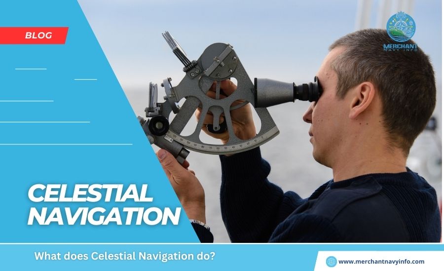
Observations
Navigators use instruments such as sextants to move between celestial bodies of interest (sun, moon, etc.) Determine the angle to measure stars and planets) and the visible horizon. This angle is called the elevation angle and serves as a key data point for calculating the observer’s position.
Timekeeping
Accurate timekeeping is of utmost importance in celestial navigation. Navigators need to know the exact time of observation in order to calculate their position accurately. In the past, this was accomplished with chronometers, precision timepieces that kept accurate time even under the difficult conditions of sea and air travel.
Calculations
The Navigator uses the altitude of the observed object and the time of observation to perform calculations to determine its position. This includes references to ephemerides, visual acuity charts, and mathematical formulas for calculating the observer’s position relative to celestial bodies.
Plotting
Once the calculation is complete, the Navigator plots the resulting line of position (LOP) on a navigation chart or map. By intersecting multiple LOPs of different astronomical objects observed at the same time or at different times, the Navigator can accurately determine its position.
Corrections
Various corrections must be applied to observations to account for factors such as the curvature of the Earth, refraction of the atmosphere, and the motion of celestial bodies. These corrections improve accuracy in determining observer position.
Conclusion
Despite its ancient origins, ship navigation remains an essential skill for modern sailors. By mastering the principles and techniques, sailors, aviators, and adventurers can navigate the seas and skies safely, guided by the timeless wisdom of the universe. In an ever-changing world, the art of navigation through the stars serves as evidence of humanity’s constant pursuit of exploration and discovery.